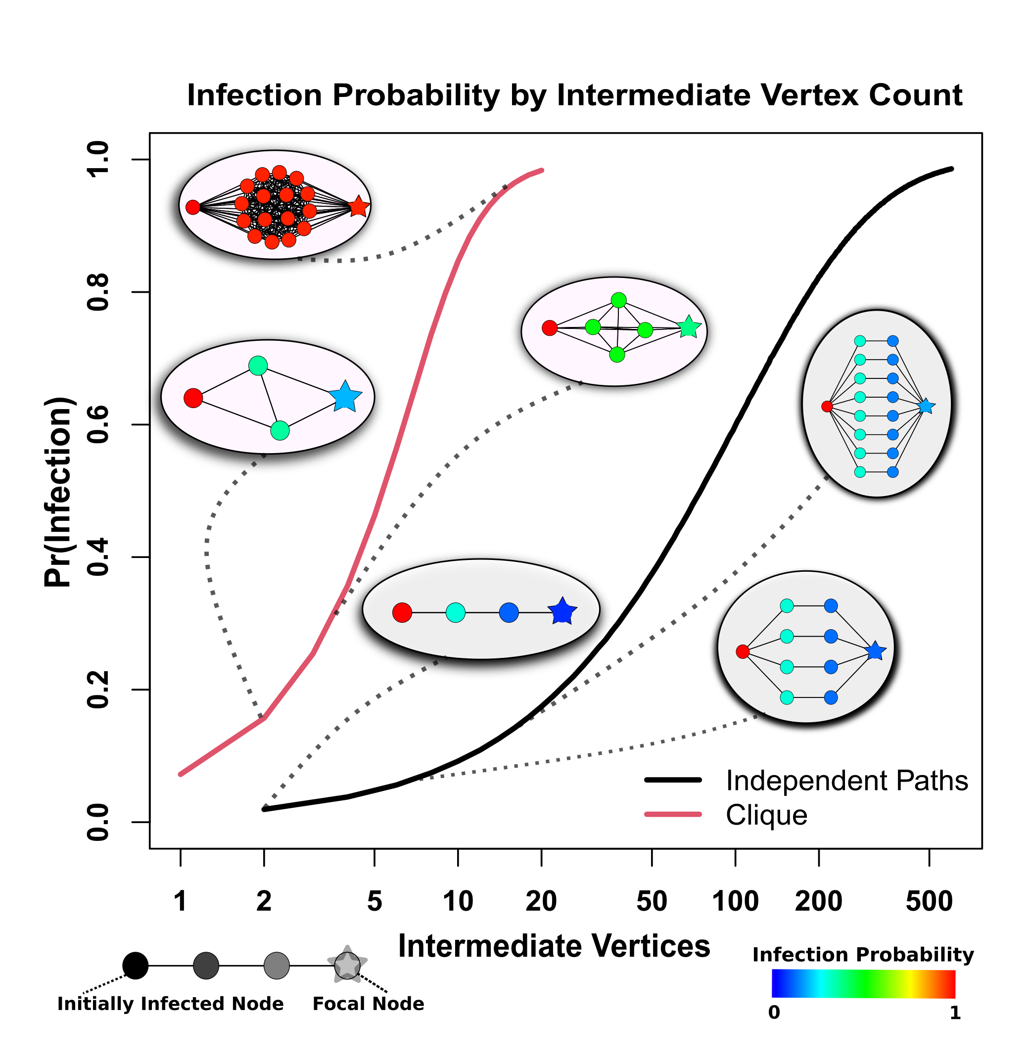
With the explosive increase in COVID-19 infections across urban environments during March of 2020, questions about how it spreads unevenly across cities needed to be addressed. NCASD researchers Loring Thomas, Peng Huang, Fan Yin, Junlan Xu and Carter Butts, in collaboration with John Hipp and NCASD alumnus Zack Almquist (University of Washington) investigated the geographical patterns of COVID-19 infection in San Francisco. By examining the spread of the disease using diffusion across social contact networks instead of standard epidemiological compartment models, researchers captured more of the unevenness present in the spread of the disease during the first weeks of the pandemic. Using social network analysis, simulation methods, and survival analysis, researchers found that while the number of social contacts a person has does contribute to their risk of infection, the extent to which their social contacts are embedded in a cohesive community described the risk better. In other words, understanding infection risks requires us to look beyond an individual’s situation, and look into the social environment one resides in. While highly connected communities are often safer in the context of disasters, as the communities can share resources more effectively, with COVID, this cohesion directly increases the risk of infection for this community.
Findings about the specific sources of structural risk provide insights into potential responses for future disease or variant outbreaks. During the first part of a novel disease outbreak, resources are often unallocated. This research can provide some potential heuristics for targeting resources to particularly vulnerable populations by building metrics to identify the geographical “high grounds” and “floodplains” in a pandemic crisis.
